How 3D Technologies Are Transforming Oil Exploration
3D seismic, geological modeling, reservoir simulation and digital twins have turned oil exploration from a speculative gamble into a precise, data-driven science.
 By the editorial teamPetrole.Africa
Introduction
Historically, oil prospecting was an undertaking marked by considerable uncertainty, high financial risk and substantial environmental impact. Traditional methods, such as rudimentary 2D seismic surveys, provided only limited, planar glimpses of complex subsurface geology, frequently leading to speculative drilling and a higher incidence of dry or low-yielding wells. The inherent opacity of the Earth's subsurface made the accurate identification and characterization of hydrocarbon reservoirs extremely difficult, directly contributing to the heightened financial and environmental risks associated with exploratory drilling campaigns.
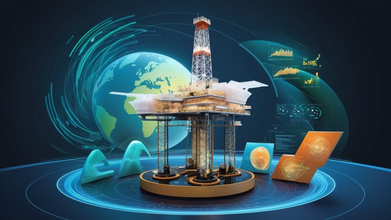
The advent of 3D technologies, pioneered by ExxonMobil several decades ago, marked a fundamental paradigm shift, transforming oil exploration from a largely speculative undertaking into a highly precise, data-driven science. This transformation represents a profound shift for oil exploration, which was previously a trial-and-error activity, into a scientific discipline characterized by a high degree of precision. 3D technologies have made it possible to move away from "random" drilling and to reduce the need for "multiple exploratory wells", implying a dramatic decrease in the uncertainty and risk inherent in oil exploration. This change is redefining the industry, turning a high-stakes gamble into a more predictable, engineering-driven discipline, which can attract more calculated investment and fundamentally alter the risk profile of exploration projects. These transformative technologies encompass advanced 3D seismic imaging, sophisticated 3D geological modeling, powerful 3D visualization tools and the emerging application of digital twins, collectively offering unprecedented insights into the subsurface world and revolutionizing decision-making throughout the exploration life cycle.
The true transformative power lies not in the isolated adoption of these technologies, but in their holistic integration. Seismic data feeds geological models, these models are then used for reservoir simulation, and all of these processes are enhanced by visualization and digital twins. This interconnection creates a powerful feedback loop in which the results of one stage inform and refine the next, producing a cumulative effect on accuracy, efficiency and risk mitigation throughout the full life cycle from exploration to production. Companies that successfully implement a fully integrated 3D workflow gain a significant and lasting competitive advantage, moving toward a truly digital exploration ecosystem.
This report will systematically analyze how 3D technologies have fundamentally reshaped oil exploration. It will examine the specific mechanisms, the multiple benefits and the real-world applications of these tools, demonstrating their impact on improving accuracy, mitigating risk, enhancing cost-effectiveness, reducing environmental footprint and optimizing operational decision-making.
I. The Foundations of the 3D Revolution in Oil Exploration
A. Evolution of Traditional Exploration Methods
Before the widespread adoption of 3D seismic, 2D methods provided only a two-dimensional cross-section of the subsurface. This approach offered "limited glimpses" and often left considerable uncertainty in the interpretation of complex subsurface structures. It was particularly difficult to precisely define the subsurface structure or to image subtle amplitude anomalies, especially in geologically complex areas such as those with mud flows.
Conventional drilling practices frequently relied on drilling multiple exploratory wells based on less accurate geological data. This "random" drilling approach was inherently inefficient, increasing costs, time and environmental disruption because of a higher probability of dry or low-yielding wells. Vertical drilling was the predominant method until the 1980s, which inherently limited the recovery potential of laterally extensive reservoirs. The traditional approach, which consisted of drilling "somewhat at random" or requiring "several exploratory wells", resulted in a high rate of unproductive or low-yielding wells. This translated directly into significant financial losses, wasted resources and extended project timelines.
The invention of horizontal drilling in the 1980s marked an important step toward more efficient recovery. This technique, using flexible pipes and steerable drill bits, allowed better access to hydrocarbon deposits from a single well and reduced the surface impact compared with multiple vertical wells. This innovation, although distinct from 3D imaging, laid the groundwork for the precision and reduced footprint that 3D technologies would later amplify. The adoption of 3D technologies directly addressed this inefficiency by minimizing "wasted effort" and reducing the need for "physical prototypes" (in the sense of exploratory wells acting as physical prototypes for production). This fundamentally changes the economic risk profile of exploration projects by increasing the probability of success per well drilled, resulting in substantial long-term cost savings and better capital allocation.
B. Overview of Key 3D Technologies
3D seismic is a foundational technology that uses sound waves to generate a three-dimensional map of subsurface formations, working somewhat like an MRI for the Earth's subsurface. It involves collecting seismic data along closely spaced lines over an area of interest, providing significantly increased resolution and improved interpretation capabilities compared with its 2D predecessor.
3D geological modeling involves creating sophisticated computer models of the subsurface, detailing the structure of rock layers and critical geological features. Geologists use these models to identify potential oil-bearing formations and determine the most strategic drilling locations, moving away from speculative drilling. The process integrates various types of data to build a comprehensive 3D understanding.
3D visualization is a technique that transforms complex, multidimensional datasets into intuitive, interactive graphical representations. It allows geologists and engineers to visually explore complex geological structures, analyze reservoir properties and understand fluid distribution in three-dimensional space, thereby greatly improving understanding and facilitating data-driven decision-making.
Digital twins represent an advanced application of 3D technology, being dynamic virtual replicas of physical assets, systems or processes. These digital counterparts are continuously fed with real-time data from sensors and IoT devices, enabling accurate replication and simulation of physical performance. This allows continuous monitoring, predictive analysis and optimization of operations at various stages, including upstream exploration and reservoir management.
Traditional methods such as 2D seismic offered "limited glimpses" and were often "insufficient" for a complex understanding of the subsurface. By contrast, 3D technologies are described as "advanced methods for collecting, processing and interpreting seismic data in three dimensions", creating "computer models of the subsurface", and enabling "real-time data integration" and the development of "digital twins". This progression indicates a shift from static, fragmented data representations to dynamic, integrated and interactive digital environments. This paradigm shift allows continuous refinement of subsurface understanding, enabling sophisticated predictive analytics and proactive decision-making that were previously impossible. The integration of these technologies creates a holistic view of the reservoir and the operating environment, which is crucial for maximizing efficiency and adaptability throughout the asset life cycle. This integrated approach is a cornerstone of modern, intelligent field management.
II. 3D Seismic: Precise Mapping of the Subsurface
A. Principles and Process of 3D Seismic Acquisition
The 3D seismic survey works on the principle of echo technology, using acoustic sound waves to locate oil formations at great depths, much as an MRI produces a map of the human body. The sound waves are generated by a seismic source and travel through the subsurface, reflecting when they encounter changes in rock type or acoustic impedance.
The reflected sound waves are then recorded by highly sensitive receivers, called geophones on land and hydrophones at sea. These devices are so sensitive that they can detect tiny vibrations, such as raindrops hitting them. Modern 3D seismic acquisition systems, such as the OYO GSR wireless recording system, represent significant technological advances. These autonomous, continuous recording systems use GPS for precise positioning, are lightweight and leave a very small environmental footprint thanks to the absence of cables. This improves operational efficiency and minimizes disturbance to the survey area.
B. Improving Mapping Resolution and Accuracy
3D seismic offers a significantly more complete and accurate understanding of subsurface geology compared with traditional 2D methods, which offered "limited glimpses, often leaving room for uncertainty". By collecting data along closely spaced lines over an area of interest, 3D seismic provides "increased resolution and improved interpretation tools and data displays".
This technology produces highly accurate representations of subsurface geology, allowing energy companies to gain a comprehensive understanding of the spatial arrangement of rock layers, faults and reservoirs. This accuracy is invaluable for confidently identifying hydrocarbon deposits and planning drilling operations.
Real-world applications underline the clear advantage of 3D seismic. Walter Oil & Gas, for example, found that while 2D seismic was insufficient to define subsurface structures or image amplitude anomalies in difficult areas, new 3D surveys with advances in processing and acquisition techniques revealed previously undetected amplitude anomalies, leading to the discovery of highly productive oil and gas sands. Similarly, existing 3D data that were "poorly resolved" could be significantly improved by new 3D surveys with better acquisition parameters, enabling deeper imaging and the identification of promising anomalies at greater depths.
C. Innovations and Advanced Techniques
ExxonMobil, a pioneer of 3D seismic imaging, has considerably advanced the technology, notably through the development and application of full-waveform inversion (FWI). FWI is an integral part of its exploration and development efforts, leveraging supercomputer technology to process the full complexity and massive quantity of seismic wave data.
FWI offers unmatched insights into subsurface geological structures and the physical characteristics of rocks, producing high-definition images that precisely map geological structures and determine with greater certainty whether the rock may contain hydrocarbons. This capability facilitates the identification and targeting of oil and gas resources, leading to more efficient, less costly and more environmentally friendly development through optimized drilling.
Recent advances in 3D seismic allow the acquisition of broader sound wave frequencies, giving geoscientists and engineers more information about subsurface properties. In addition, the innovative application of land-based simultaneous multiple seismic source methods has been extended to offshore environments, considerably reducing data acquisition time, costs and environmental impact.
D. Impact on Hydrocarbon Discovery and Case Studies
3D seismic imaging profoundly improves the identification and characterization of oil and gas reservoirs. The technology allows operators to visualize the size, shape and properties of potential reserves with greater clarity, which helps avoid dry wells and ensures that resources are extracted efficiently.
By providing detailed information on subsurface conditions before drilling begins, 3D seismic considerably reduces financial and environmental risks. Operators can proactively avoid geohazards, leading to safer operations and reducing the likelihood of costly setbacks or accidents.
The precise information derived from 3D seismic imaging facilitates accurate well placement, ensuring that drilling targets the most productive zones. This reduces the number of exploratory wells required, saving considerable time and resources. Once production has begun, the data continue to prove invaluable by guiding reservoir management strategies, maximizing recovery rates and extending the productive life of reservoirs.
Although 3D seismic imaging requires an upfront investment, it ultimately proves highly cost-effective over the long term. By reducing uncertainty, increasing exploration success rates, minimizing dry wells and optimizing resource extraction, energy companies can achieve significant savings over time.
3D seismic is not limited to simply mapping subsurface formations; it also makes it possible to infer the intrinsic properties of the rock and of the fluids it contains. This advanced characterization capability allows a more confident and detailed assessment of a prospect's viability before any drilling, fundamentally transforming the exploration decision-making process from a question of "where is the structure?" to "what is in the structure, and in what quantity?". This considerably de-risks the exploration phase.
An important, often unintended, benefit of 3D seismic is the substantial reduction in environmental impact. The data indicate that 3D seismic "considerably reduces the impact on the environment, because it eliminates the need to drill multiple exploratory wells". This positions 3D seismic not only as a tool for economic optimization, but also as an essential technology for sustainable and responsible resource development, aligning with growing regulatory and public pressure for greener operations. This environmental benefit can also speed up permitting processes by demonstrating a commitment to reducing ecological risks.
The advancement and full use of 3D seismic technology are intrinsically linked to the parallel evolution of high-performance computing (HPC) and sophisticated data-processing algorithms. Processing and analyzing seismic data is a "massive computational task", and historically the industry could use only a "portion of the recorded data" because of its complexity and quantity. The ability to collect far more detailed data (for example, broader frequencies, simultaneous sources) would be pointless without the computing power required to process it, interpret it and extract actionable insights from it. This implies that continued innovation in exploration technology will depend heavily on ongoing advances in computing infrastructure, data science and artificial intelligence.
Table 1: Comparison of 2D and 3D Seismic Methods
| Characteristic | 2D Seismic | 3D Seismic |
|---|---|---|
| Resolution | Limited (planar view) | High (volumetric view) |
| Subsurface Understanding | Partial (cross-sections) | Complete (3D modeling) |
| Data Acquisition (Coverage) | Spaced lines | Dense grid |
| Environmental Impact (Exploratory Wells) | High (more dry wells) | Low (fewer dry wells) |
| Risk Reduction | Higher (uncertainty) | Lower (precise targeting) |
| Cost-Effectiveness | Lower upfront cost, but potentially higher overall cost due to inefficiency | Higher upfront cost, but lower overall cost due to efficiency |
| Data Interpretation | Basic | Advanced (with FWI, etc.) |
III. 3D Geological Modeling and Reservoir Simulation: Understanding and Predicting
A. Building 3D Geological Models of the Subsurface
Geological modeling involves creating sophisticated computer models of the subsurface, representing the complex structure of rock layers and critical geological features. This advanced approach has fundamentally shifted exploration from "somewhat random" drilling to a highly targeted and informed process, guiding geologists on where to drill for optimal results.
The models are meticulously built to locate and characterize the specific geological features crucial to hydrocarbon accumulation:
- Porous Rocks: Identification of porous reservoir rocks, typically sandstone, which have the interconnected cavities and channels needed to store oil and gas. These formations often originate from ancient sand deposits, later compacted by overlying rock layers.
- Cap Rocks: Precise mapping of impermeable cap rocks, such as shale, which must overlie and seal the porous sandstone to prevent the upward migration and escape of hydrocarbons. The shape of these cap rocks, often funnel-like, is essential for trapping oil.
- Fault Traps: Accurate location and modeling of fault lines, which are displacements between rock layers. When a layer shifts upward at an angle, these faults can create highly effective traps for oil. Understanding faults is paramount, because small-scale faults can act as fluid migration pathways, while large offsets can form impermeable barriers due to fault gouge.
These models integrate a wide range of data sources to build a holistic understanding of the subsurface:
- Well Logs: Measurements taken at different depths in drilled wells, providing crucial data on rock properties such as electrical conductivity, gamma-ray emissions, neutron particle densities, resistivity and the time it takes sound to travel through the rock (sonic logging). Although they do not directly measure porosity or permeability, these logs have established statistical relationships with those desired properties.
- Seismic Data: 3D seismic "cubes" provide invaluable information about the layering and general shape of the rocks in the time domain.
- Time-Depth Conversion: A critical step in which time-based seismic data are accurately converted into depth-based data. This is achieved by combining seismic data with well logs from test boreholes. Geologists compare the transitions between rock layers observed in well logs measured in depth with the layers in seismic data measured in time. By measuring acoustic properties from the well logs, synthetic seismic signals can be created and then stretched or compressed in the software to match the actual seismic data around the well. This process establishes an accurate relationship between time and depth, enabling the production of 3D surfaces called "horizons" that delineate the intersection between different rock layers across the entire seismic cube.
After the horizons are defined, geologists create "zones" to represent the areas between these layers. Using well logs and statistical analysis, they determine and assign rock properties such as porosity (the total space available for oil) and permeability (how well the cavities are connected for fluid flow) within these zones. To account for the complex, non-homogeneous nature of reservoirs (for example, meandering river deposits), the model is then subdivided into a small-scale 3D grid of generally cubic cells. Each cell is assigned specific values for porosity, permeability and rock type, enabling accurate calculations of total oil in place and serving as the basis for reservoir simulations.
B. 4D Reservoir Simulation for Predicting Fluid Movement
Reservoir simulation enables an asset team to make a "best estimate" of the dynamic distribution of oil, gas and water within a reservoir over time. It uses the 3D geological model as a robust framework to simulate the migration and flow of fluids through the reservoir. The "4D" aspect refers to the inclusion of time as a dimension, allowing temporal analysis and the prediction of future fluid movement.
This process typically involves upscaling the accurate 3D geological model and its properties into a grid suited to simulation. Inputs such as pressures, fluid parameters and fault transmissibilities are meticulously chosen and adjusted to match the historical production data and well tests known for the area. Computer simulations are then run to predict where fluids will migrate or be trapped over time.
Reservoir simulation offers a powerful visual representation of fluid movement in the subsurface. It clearly shows where the highest concentrations of oil and gas are located, and identifies areas depleted of fluids and pressure. This critical information is invaluable for avoiding unproductive zones when planning future drilling operations.
Initially, geological models provide a "3D model of the subsurface" or a static "framework". However, integrating "reservoir simulation" and, more specifically, "4D reservoir simulation" turns this static understanding into a dynamic and predictive tool. This allows companies to "show how oil and gas have moved over the history of a field as well as predict where the oil will be in the future". This fundamental shift from descriptive modeling to sophisticated predictive analytics is crucial for strategic decision-making in a volatile market. It enables companies to anticipate reservoir behavior, optimize production strategies over extended periods and plan future drilling campaigns with a much higher degree of confidence. This goes beyond merely finding oil to
optimizing its long-term recovery and economic viability, directly affecting the analysis of estimated ultimate recovery (EUR) and overall asset valuation.
C. Optimizing Well Planning and Reducing Drilling Risk
Integrating 3D geological models with 4D reservoir simulation is seen as an ideal way to considerably reduce the risks associated with drilling low-yielding or dry wells. This integrated approach enables precise planning of future wells in the most desirable zones, specifically targeting the layers of the reservoir most saturated with oil or gas.
Effective well planning requires integrating the simulation grid with all other relevant data. This includes the exact locations and trajectories of offset wells, fracture locations or discrete fracture network models, and even microseismic events from previous wells in the area. This holistic view ensures that all available information informs the drilling strategy.
With the time component of reservoir simulations, advanced 4D viewers such as CoViz 4D can be used to plan most, if not all, of the wells in an entire drilling campaign. By creating well plans at each individual time step of a reservoir simulation, asset teams can identify optimal fluid locations well into the future. These future plans can even be exported to the simulator to obtain an even better picture of fluid flow as if the planned wells were already online, further refining understanding and predictions. This also helps predict future performance and plan maintenance more effectively.
D. Case Studies and Benefits for Reservoir Characterization
Leading oil companies, including Chevron, Nexen Petroleum UK, ExxonMobil and BP, actively use research results (for example, from UCL's DWRG) to generate improved in-house computer-generated hydrocarbon reservoir models. These improved models are essential for better reservoir characterization and simulation, allowing companies to manage, develop and ultimately derive more value from their hydrocarbon reservoirs more effectively.
Projects such as UCL's Ainsa project, an integrated outcrop-to-subsurface study, have provided crucial "hard data" on likely reservoir continuity, porosity-permeability relationships and vertical and lateral pathways or baffles to fluid flow. The participating oil companies leveraged these data to explore and define the levels of uncertainty within their reservoirs, considerably de-risking exploration and development decisions.
A notable example is the Buzzard field, where a new model of the spatial variation of sedimentary lithofacies, developed with research from UCL's DWRG, directly influenced predictions of primary sandstone reservoir quality. Subsequent drilling operations successfully corroborated this revised depositional framework across the reservoir intervals, leading to essential revisions and updates in Nexen's later reservoir models for the Buzzard oil field.
Research and associated training programs considerably improve company employees' understanding. This enables them to make more informed decisions throughout their careers regarding reservoir management, which translates directly into companies' ability to extract more oil from reservoirs and, consequently, generate greater revenues.
The modeling process is "not linear but iterative", and "new data from additional wells and extended oil production (history matching, comparing actual production with forecasts) are continuously fed back into the model". In addition, future well plans can be exported to the simulator to obtain an "even better picture of fluid flow". This underlines that geological modeling and reservoir simulation are not one-off tasks, but rather continuous, adaptive processes. The models are living entities that improve and gain fidelity with each new piece of data gathered during exploration, development and ongoing production. This iterative refinement minimizes uncertainty throughout the asset life cycle, leading to sustained optimization, maximization of a field's economic potential and the promotion of a culture of continuous learning and data-driven adaptation within asset teams.
A significant and often overlooked challenge in subsurface modeling is the integration of data from vastly different scales, from the microscopic rock properties measured by well logs to the kilometer-scale geological features identified by seismic surveys. Geological modeling serves as a crucial bridge, enabling data upscaling and reduction, as well as statistical inference of properties, to create a coherent, multi-scale understanding of the reservoir. This "scale integration" capability is fundamental to the accuracy and predictive power of these models, enabling a comprehensive view that no single data type could provide on its own.
Table 2: Key Benefits of 3D Geological Modeling and Reservoir Simulation
| Benefit Category | Key Details |
|---|---|
| Subsurface Understanding | Comprehensive 3D visualization of rock layers, faults and fluid distribution; Accurate identification of oil traps (porous rocks, cap rocks, fault traps); Detailed characterization of rock properties (porosity, permeability); Prediction of fluid movement and depletion over time (4D). |
| Risk Mitigation | Significant reduction in dry wells and low-yielding wells; Avoidance of geohazards; Reduced financial exposure; In-depth understanding of reservoir uncertainties. |
| Well Planning | Optimized well placement to target the most hydrocarbon-saturated zones; Strategic planning of future drilling campaigns (4D); Integration of existing well data and microseismic data for informed decisions. |
| Reservoir Management | Maximization of hydrocarbon recovery rates; Extension of the productive life of reservoirs; Optimization of water injection strategies for enhanced recovery; Real-time monitoring of reservoir performance. |
| Economic Impact | Improved profitability of exploration and production projects; Reduced operating costs through better planning and greater efficiency; Optimization of long-term asset value. |
| Data Integration | Consolidation of diverse data sources (seismic, well logs, production data) into a coherent model; Improved decision-making through a unified view of the subsurface; Facilitated collaboration among asset teams. |
Export to Sheets
IV. 3D Visualization and Digital Twins: Improving Decision-Making and Operational Efficiency
A. 3D Visualization Techniques and Tools for Complex Data
Data visualization is a powerful tool for oil professionals, enabling them to better understand complex data, identify trends and make data-driven decisions. 3D visualization excels specifically at representing complex datasets in a more intuitive and interactive way, turning raw data into actionable insights.
It enables geologists and engineers to gain a deeper understanding of subsurface geology by visualizing complex geological structures such as reservoirs and faults. For example, a detailed 3D reservoir model can display the distribution of critical properties such as porosity, permeability and fluid saturation, which is crucial for identifying high-potential zones and optimizing well placement and completion strategies.
Advanced visualization tools, such as CoViz 4D, are essential for harnessing the full power of well planning. They facilitate the integration of simulation grids with other relevant data, including the exact locations and trajectories of offset wells, fracture locations or discrete fracture network models, and even microseismic events from previous wells. This comprehensive integration gives decision-makers a holistic view.
Popular data visualization tools widely adopted in the oil industry include Tableau, Power BI, D3.js and Spotfire. These platforms offer robust features such as interactive dashboards, data blending capabilities (combining data from multiple sources) and predictive analytics features that allow users to forecast future trends.
Remote 3D visualization solutions, often powered by high-performance computing (HPC), are essential for enabling seamless collaboration on large image models between clients and partners, even outside the company network. This improves accessibility, speeds up decision cycles and improves overall project efficiency.
B. Applying Digital Twins in Exploration and Production
Digital twin technology involves creating virtual replicas of physical assets, systems or processes. These digital counterparts are continuously fed with real-time data from sensors and Internet of Things (IoT) devices, allowing them to accurately replicate and simulate the performance of their physical counterparts. This capability allows organizations to monitor, analyze, predict and optimize their operations more effectively at various stages of the oil and gas value chain.
In upstream exploration and production, reservoir modeling is a key application of digital twins. By creating a digital twin of the reservoir, engineers can simulate reservoir behavior over time, predict its response to different extraction techniques and identify the most efficient drilling plan for each well. This application is perhaps the most impactful for upstream operations, enabling remote monitoring, anomaly detection and real-time adjustment of parameters such as pressure, temperature and flow rate to optimize production.
Digital twins of the entire drilling process, from the rig to the wellbore, are invaluable. They can alert operators to potential risks in real time, such as stuck pipe or equipment failures. Live data from sensors on the drill bit, the wellbore and surface equipment allow the digital twin to optimize drilling parameters (for example, mud flow rate, torque, rate of penetration), thereby minimizing dangerous human errors and considerably improving the overall efficiency of drilling operations. For example, an advanced 3D simulation system delivered a notable 20% improvement in predictability and a substantial 40% increase in collision avoidance in offshore drilling scenarios.
Digital twins are crucial for managing complex oil and gas facilities. Using data from sensors embedded in structures (for example, stress, strain and corrosion sensors), a digital twin can continuously monitor the health of these assets, simulating deterioration over time to predict when and where potential structural failures might occur. In addition, 3D laser scanning is essential for creating highly accurate digital replicas (point clouds) of existing facilities with millimeter precision, enabling accurate as-built documentation, facility design validation, maintenance planning and remote inspections.
Digital twins of oil and gas facilities, such as offshore platforms or refineries, can simulate various emergency situations (for example, gas leaks, explosions). This allows operators to test and refine their emergency response plans under different scenarios, identifying areas for improvement. Beyond operational safety, 3D visualization also plays a role in environmental management by visually articulating complex environmental datasets to enable key decisions, allowing faster, cheaper and more effective remediation compared with traditional 2D analysis.
C. Impact on Safety, Cost Reduction and Operational Efficiency
3D visualizations and digital twins significantly improve safety by enabling potential construction problems to be identified before work even begins, virtually eliminating on-site safety issues related to critical lifts and effectively de-risking major shutdowns through detailed virtual planning and analysis. These technologies also enable remote measurements in hazardous areas, considerably reducing human exposure to risk and helping with compliance with strict safety standards such as OSHA, API and MSHA.
By providing visual insights that allow designs and schedules to be refined, potential problems can be resolved proactively in the virtual environment, avoiding costly rework and promoting on-time project completion. This proactive approach delivers significant savings, as shown by a case study in which real-time data monitoring via interactive dashboards resulted in a 15% reduction in drilling costs. In addition, 3D laser scanning contributes to cost reduction by eliminating the need for physical prototypes and minimizing rework.
3D visualization and digital twins considerably improve operational efficiency overall. They speed up shutdown planning, enable proactive asset management by allowing operators to identify wear, corrosion or misalignment before they become costly problems, and support real-time data integration for informed decisions during exploration and drilling. The ability to optimize well placement and completion strategies directly affects productivity and resource recovery.
D. Role in Communication and Stakeholder Engagement
Technically accurate 3D visualizations offer realistic, real-time representations of complex assets, resulting in considerably higher levels of communication, clarity and engagement for all stakeholders, from internal teams to outside investors and regulators.
Visualization simplifies inherently complex technical narratives, improving education and training for better outcomes, including compliance with safety protocols. This capability is also essential for bridging communication gaps among consultants, clients, regulators and the public by presenting easy-to-understand visualizations of complex site processes, environmental conditions and treatment/cleanup plans.
3D visualizations provide strong support for tenders and improve bid and proposal presentations, which can speed up approvals by providing clear and comprehensive visual information.
Conclusion
The integration of 3D technologies has fundamentally transformed the oil exploration landscape, turning it from a high-risk, speculative undertaking into a data-driven precision science. 3D seismic has revolutionized subsurface mapping by offering unmatched resolution and understanding of geological structures, thereby minimizing the need for exploratory drilling and reducing environmental impact. 3D geological modeling and 4D reservoir simulation have enabled a dynamic understanding of hydrocarbon systems, allowing the prediction of fluid movement and the strategic optimization of well placement, thereby considerably reducing the risk of dry wells and increasing resource recovery. Finally, 3D visualization and digital twins have amplified these benefits by improving real-time decision-making, strengthening operational safety, reducing costs and facilitating clear communication and engagement with all stakeholders.
The power of these technologies lies in their synergy, creating an integrated exploration ecosystem in which data from one stage refine and inform the next, leading to continuous improvement and greater efficiency throughout the asset life cycle. This holistic approach not only maximizes the economic potential of oil fields, but also supports more sustainable and responsible exploration practices. As the industry continues to evolve, the continued adoption of and innovation in 3D technologies will remain essential to meeting the complex challenges of hydrocarbon exploration and production, ensuring safer, more efficient and more environmentally friendly exploitation of the world's energy resources.

 Sudan